
[awesome-weather owm_city_id=”2759794″ location=”Amsterdam, NL” size = “wide” units=”F” forecast_days=”5” show_link=”1″ background_by_weather=”1″ hide_attribution=”1″ show_icons=”1″]
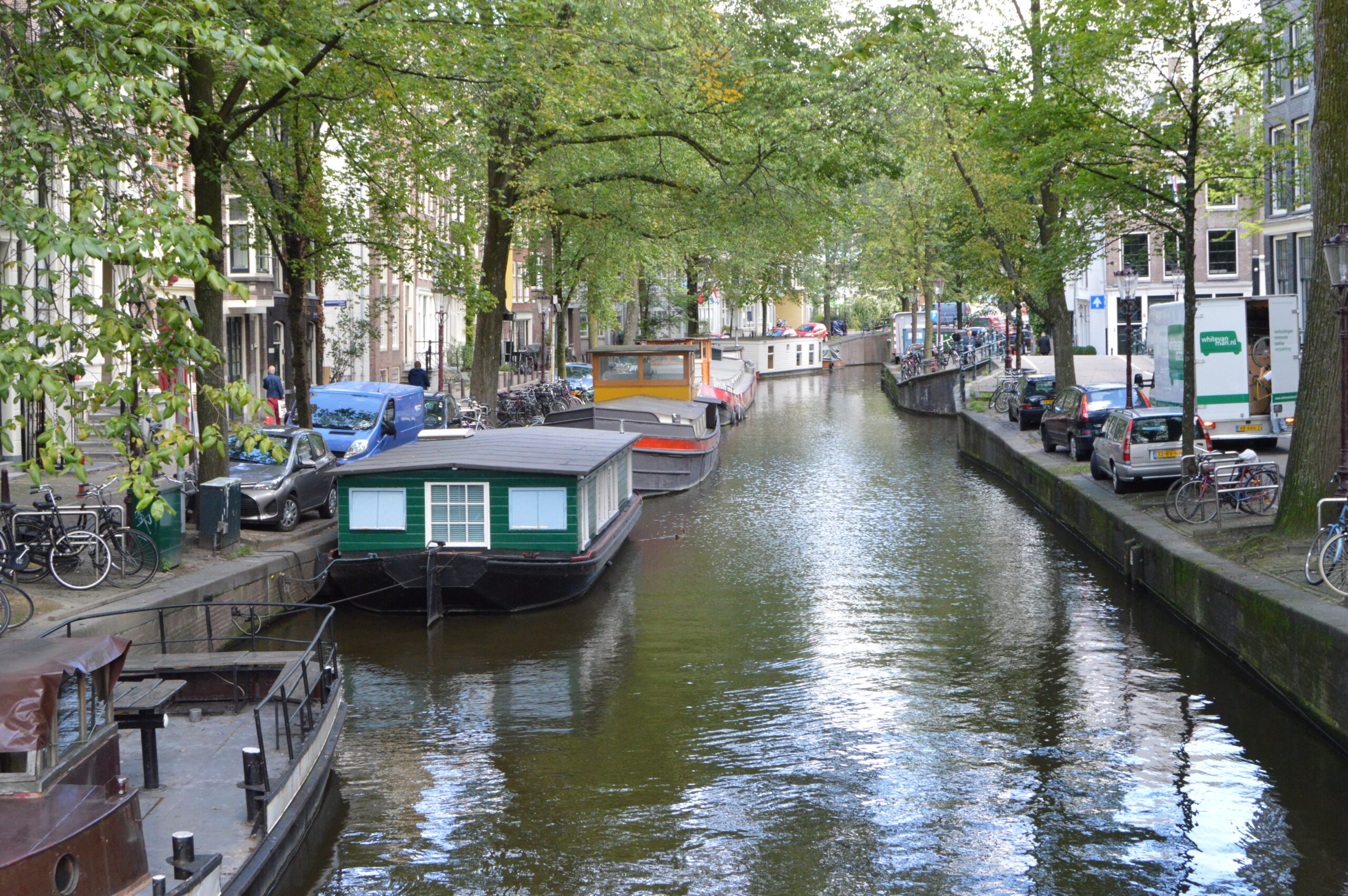
Starting as a small fishing village in the 12th century Amsterdam became a major center for world trade during the Dutch Golden Age in the 17th century. It started the first stock exchange and was the pioneer of capitalism. It expanded rapidly during the 18th & 19th centuries. It’s social practice of non-conformism, tolerance and progressivism has attracted people from different countries. Its population is one of the worlds most diverse. The ambience of the inner city’s canals and architecture make it one of the most desirable cities to visit.
Regions of Amsterdam…
Binnestad
Canal District
Jordaan
Plantage
Zuid
West
Noord
Oost
Zuidost
Points of Interests in Amsterdam…
Listed are some of the most interesting places to visit and see in Amsterdam.You may sort the table below by alpha name, type of site, classification of site, area and district of Amsterdam. 🏛 denotes UNESCO World Heritage Site.
| Name | Type | Class | Area | District |
|---|---|---|---|---|
| Amsterdam Centraal | Landmark | Train Station | Binnenstad | Stationsplein |
| Royal Palace | Landmark | Palace | Binnenstad | Dam Square |
| Anne Frank House | Landmark | Bldg: Historic | Canal District | |
| Rembrandtplein | Landmark | Monument & Square | Canal District | |
| Brewer’s Canal | Landmark | Canal Street | Jordaan | |
| De Gooyer | Landmark | Bldg: Windmill | Plantage | |
| Rijksmuseum | Museum | Art | Zuid | |
| Vondelpark | Park | City Park | Zuid | |
| Museum Het Schip | Museum | Architectural | West | |
| EYE Film Institute | Museum | Theatre | Noord | |
| Tropenmuseum | Museum | Ethnographic & Cultural | Oost | |
| Bijlmermonument | Landmark | Monument | Zuidoost | |
| Bloemenmarkt | Shopping | Flowers: Tulips | Canal District | |
| Magere Brug | Landmark | Bridge | Canal District |
Day Trips from Amsterdam…
- Alkmaar
- Enkhuizen
- De Hague
- Delft
- Gouda
- Haarlem
- Hilversum
- Keukenhof
- Kinderdjik 🏛
- Leiden
- Muiden
- Naarden
- Rotterdam
- Utrecht
- Waterland
- Zaanse Schans
- Zandvoort
Transportation in Amsterdam…
✈️ Airports
Amsterdam has one major airport with alternative airports in Eindhoven and Rotterdam the Hague. Those are both a minimum of 25-30 minutes from Amsterdam and no service to the US.
AMS – Schiphol International Airport – It is the home base for KLM Royal Dutch airlines with non-stop services from 20 US cities. As Europes 5th busiest airport there is an ample choice of flights to other European destinations . Located just 15 km southwest of the city center it can be easily reach by suburban train, bus, shuttle service or taxi.
🚊 Public Transportation
Suburban Train: NS
Amsterdam Centraal Station – Main station in central Amsterdam
Sloterdijk Station – Lines out to Haarlem, Schiphol & Zaandam
Zuid Station – Station in south Amsterdam
Amstel Station – Eastern station lines to Utrecht
Bijlme ArenA Station – Southeastern station near ArenA stadium
Holendrecth Station – Southeastern station near AMC hospital
RAI Station – South Amsterdam near RAI convention center
Science Park Station – East Amsterdam near Science Park
Muiderpoort Station – Amsterdam east connect Centraal to Hilversum & Utrecht
Light Rail / Tram: GVB (digital tram route map)
#1 Muiderpoort Station ↔︎ Osdorp De Aker (Matterhorn)
#2 Centraal Station ↔︎ Nieuw Sloten (Oudenaardeplantsoen)
#3 Zoutkeetsgracht ↔︎ Flevopark
#4 Centraal Station ↔︎ Station RAI
#5 Westergasfabriek ↔︎ Amstelveen Stadshart
#7 Slotermeer ↔︎ Azartplein
#12 Centraal Station ↔︎ Amstelstation
#13 Centraal Station ↔︎ Geuzenveld (Lambertus Zijlplein)
#14 Centraal Station ↔︎ Flevopark
#17 Centraal Station ↔︎ Osdorp (Dijkgraafplein)
#19 Sloterdijk Station ↔︎ Diemen Sniep
#24 Centraal Station ↔︎ De Boelelaan/VU
#25 Staion Zuid ↔︎ Amstelveen Westwijk
#26 Centraal Station ↔︎ IJburg (IJburglaan)
Metro / Subway: GVB (Amsterdam Metro lines)(digital metro map)
#50 Ring Line-Green Line, Isolatorweg ↔︎ Gein
#51 Ring Line-Orange Line, Isolatorweg ↔︎ Centraal Station
#52 South Line-Blue Line, Noord ↔︎ Zuid
#53 East Line-Red, Gaasperplas ↔︎ Centraal Station
#54 East Line-Yellow, Gein ↔︎ Centraal Station
City Bus: GVB (digital bus route map)
22 routes (+8 rush hour, +10 night)
Ferry / Boat: GVB (digital ferry route map)
#F1 line, Isoatorweg ↔︎ Gein
#F2 line, IJplein ↔︎ Centraal Station
#F3 line, Buiksloterweg ↔︎ Centraal Station
#F4 line, NDSM ↔︎ Centraal Station
#F5 line, NDSM ↔︎ Centraal Station
#F6 line, Distelweg ↔︎ Pontsteiger
#F7 line, Pontsteiger ↔︎ NDSM
#F20 line, Hempontplein ↔︎ Zaandam
#F21 line, Spaarndam ↔︎ Assendelft
#F22 line, Velsen Zuid ↔︎ Velsen Noord
Bicycles: OV-fiets
Transit Cards / Passes: GVB travel cards, OV-chipkaart, I amsterdam City Card, Amsterdam Travel Ticket